HIDDEN GEMS OF CUYAMACA
**THIS IS AN ONGOING PAGE OF UNIQUE HIKES AND PLACES TO EXPLORE IN CUYAMACA**
If you are a business and feel like you should be included in our list, please shoot us an email: [email protected]!
Indigenous peoples in the area date back a minimum of 7000 years. Traces of their ancient and pre-contact civilizations are within the park, which is a Cuyamaca complex archeological site.
Early bedrock mortars mark the sites of summer camps and villages. Even the name “Cuyamaca” is a Spanish version of the name the native Kumeyaay peoples used for this place. The Natives called the area Ah-Ha Kwe-Ah Mac, meaning “the place where it rains.”
The park is located on the 1845 Rancho Cuyamaca Mexican land grant. With the discovery of gold in Julian in 1869, the Spanish, Mexican, and American governments and settlers changed the Kumeyaay’s way of life forever. Disease spread through the Kumeyaay, traditional ways of life were destroyed, and promises broken as the Natives were expelled in 1875 from ancestral lands and taxed without representation.
There are many hidden gems in Cuyamaca. Make sure to explore them all!
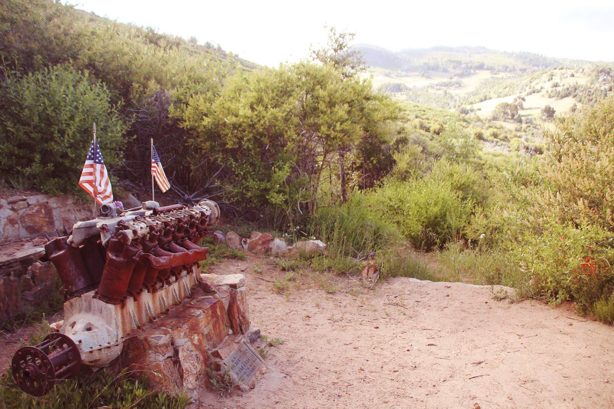
1. Airplane Crash Memorial
Located 800 feet above a trailhead near Green Valley Falls lays “one of the most sought after crash sites in U.S. military history.” The memorial site is small, consisting of a burned V-12 cylinder aircraft engine mounted on a stone & concrete pedestal and a plaque attached to the pedestal dedicated to U.S. Army pilot First Lieutenant Charles F. Webber and U.S. Cavalry Colonel Francis C. Marshall. The plaque reads “Who fell on this spot on December 7, 1922.”
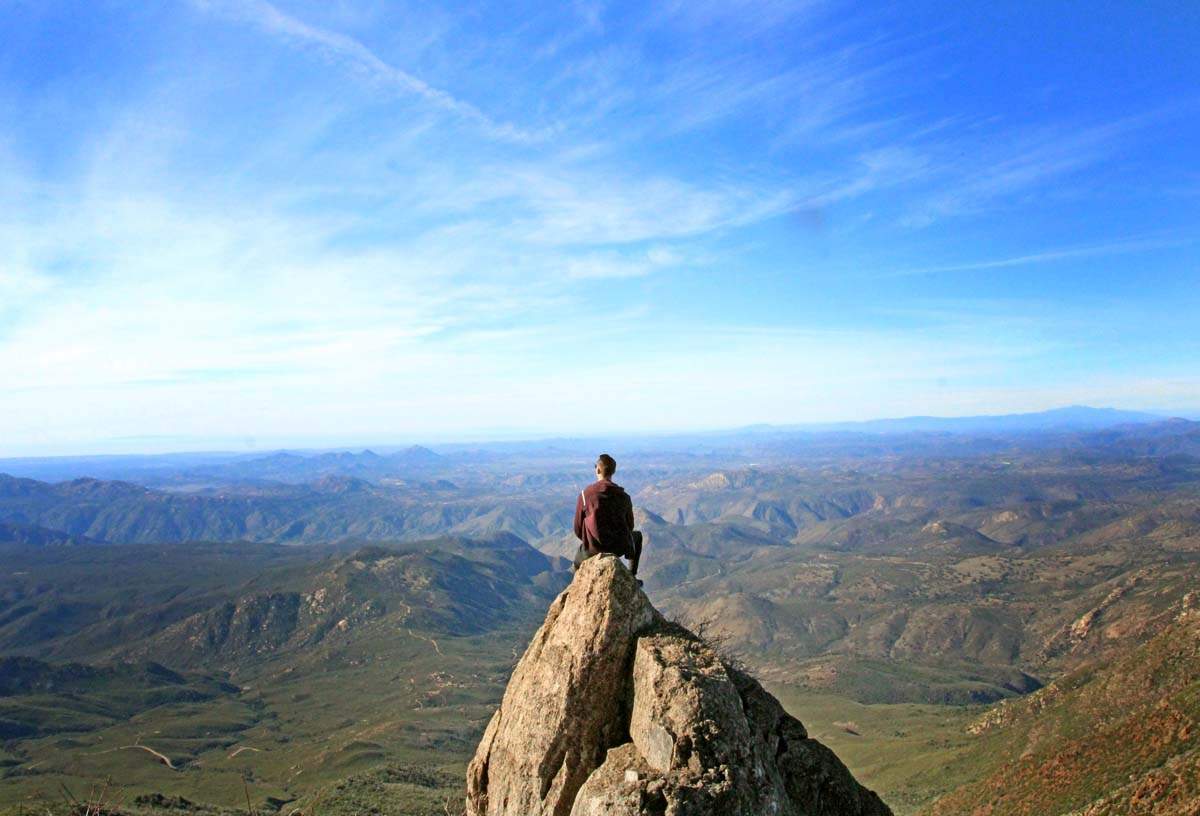
2. Cuyamaca Peak
Cuyamaca Peak is the second highest peak in San Diego County (and only 20 feet lower than the highest peak) at 6,512 ft. elevation. With a moderate climb up hill, be ready to be greeted with stunning views at the top! On a clear day you can see Mexico, the Coronado Islands, mountains in Arizona as well as views all the way to the San Bernadino Mountains!
3. Cuyamaca State Park
The state park is filled with beautiful hiking trails, a lake where you can boat and fish, a lakeside restaurant and even camping!
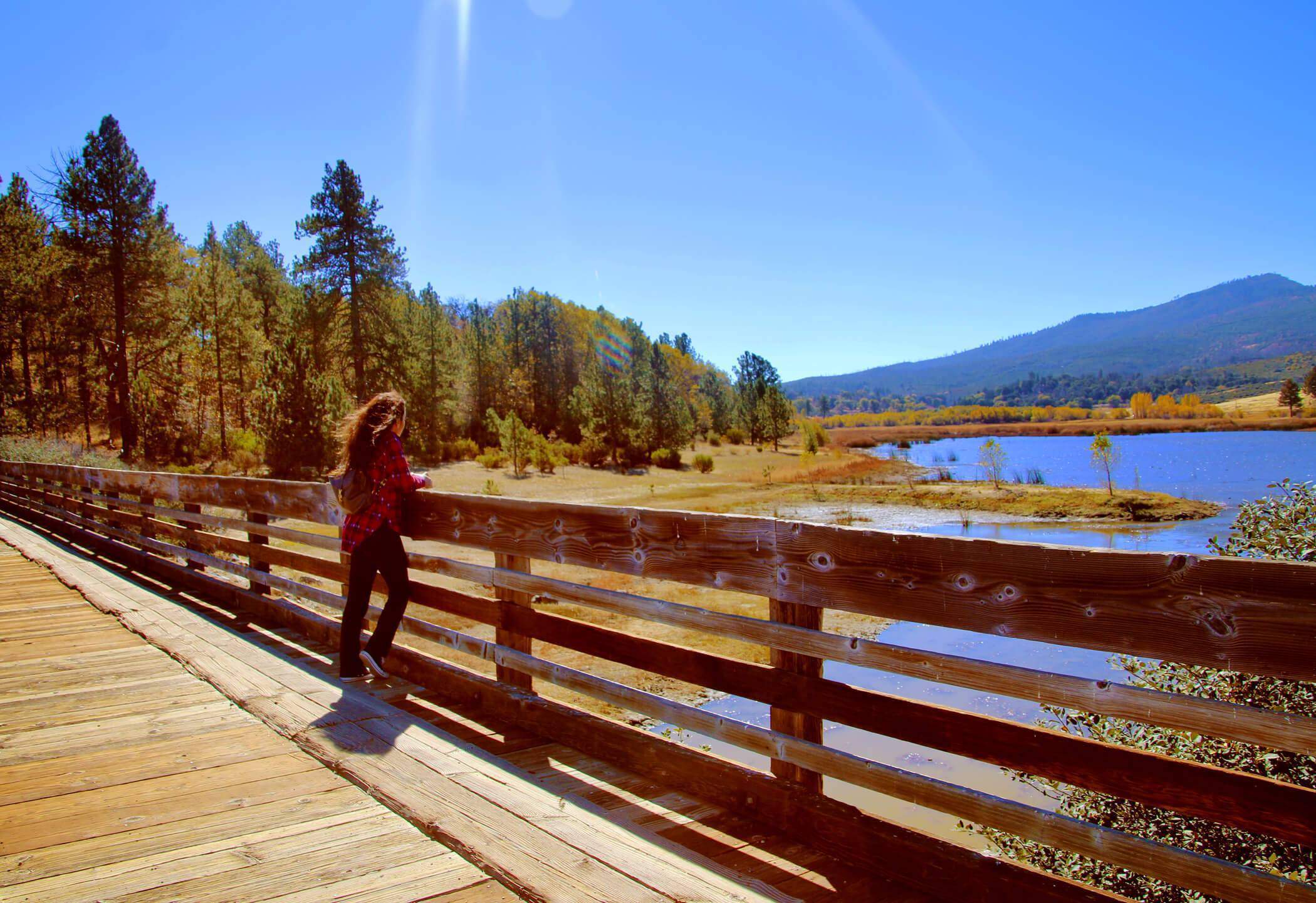
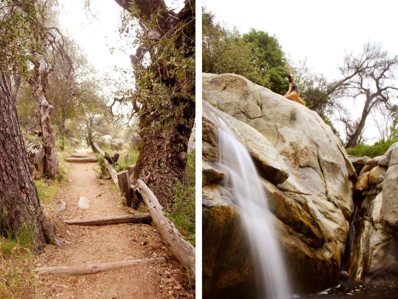
4. Green Valley Falls
Green Valley Falls lay within a campground which offers 74 campsites. They are located at an elevation of 4,000 feet where the Sweetwater River spills over boulders on its 55 mile trip southwest to San Diego Bay.
The river runs through the campground, and produces a variety of cascades and shallow pools. I imagine the cold water would be great for cooling off on hot days. The hike itself was short but very scenic.

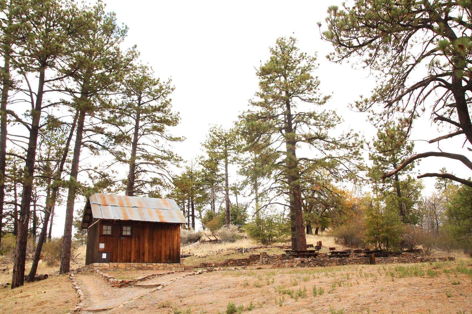
5. Stonewall Mine
The remains of the 19th century Stonewall Mine and its former workers’ community are located at the northern end of Cuyamaca Rancho State Park, next to Cuyamaca Lake Together, they are a designated archaeological site. The site is open to the public daily and has a parking lot, restroom, and picnic tables.
6. Dyar House Ruins
The Dyar house was built in 1923 and is said to have been made from the same hand-cut native stone which was also used to build the Lassator’s Green Valley Ranch. After the 2003 Cedar Fire swept through this area though, all that remains today is a skeletal structure.
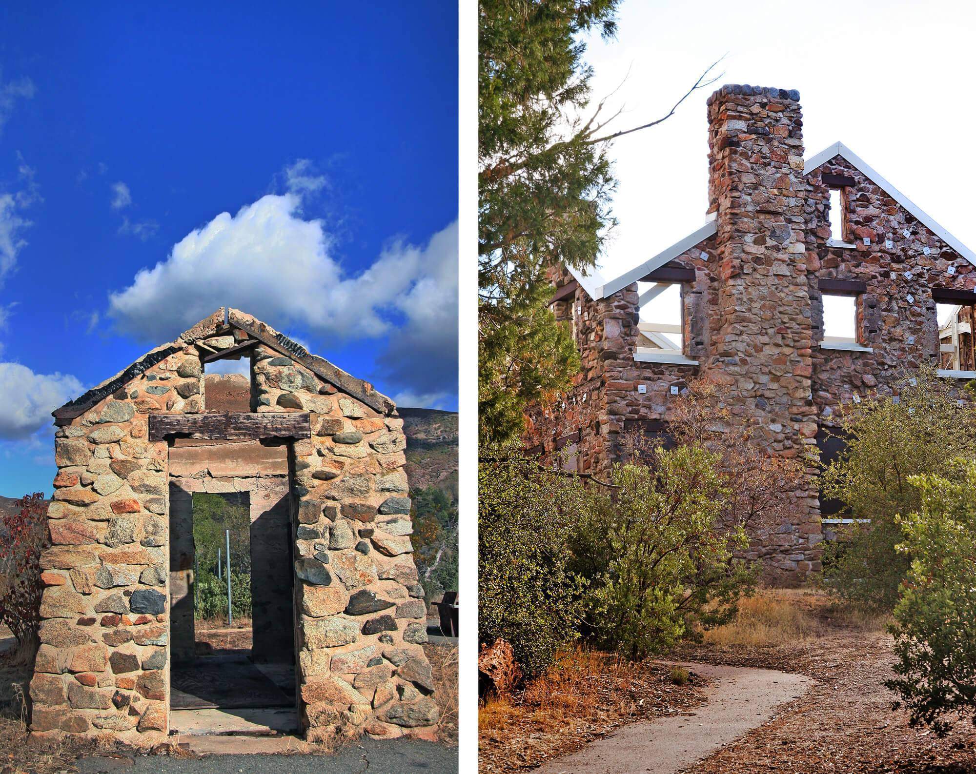
The front cover of our book, Abandoned San Diego, was also shot here! You can purchase it on this page!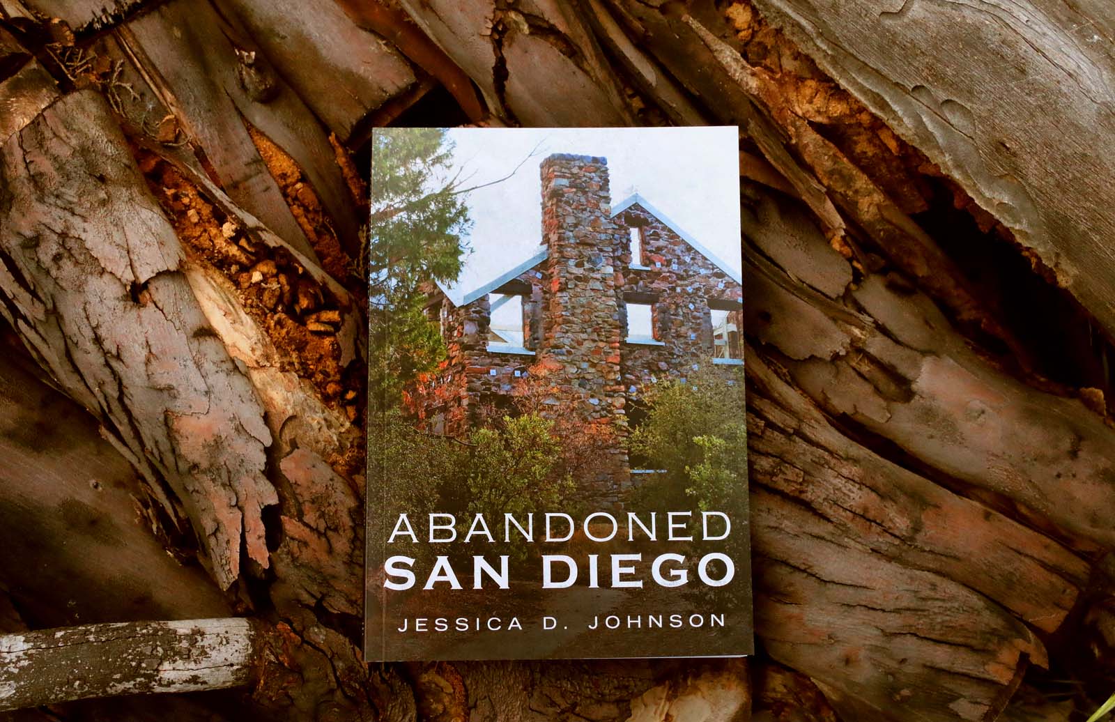
7. Cuyamaca State Park Visitor Center
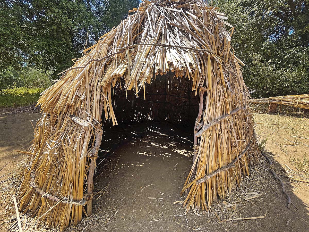
The Cuyamaca State Park Visitor Center was definitely better than I had anticipated which is probably why I had never stopped by it before. I think the most captivating feature is the mock Kumeyaay village on the side of the center.
Pretty cool to see an authentic replica up-close like this. The inside of the visitor’s center doubles as a museum with a handful of taxidermied animals including a mountain lion.